Explore UK place names on a map – my new web app
As an Easter present for you all, I’ve got a new web app you can play with.
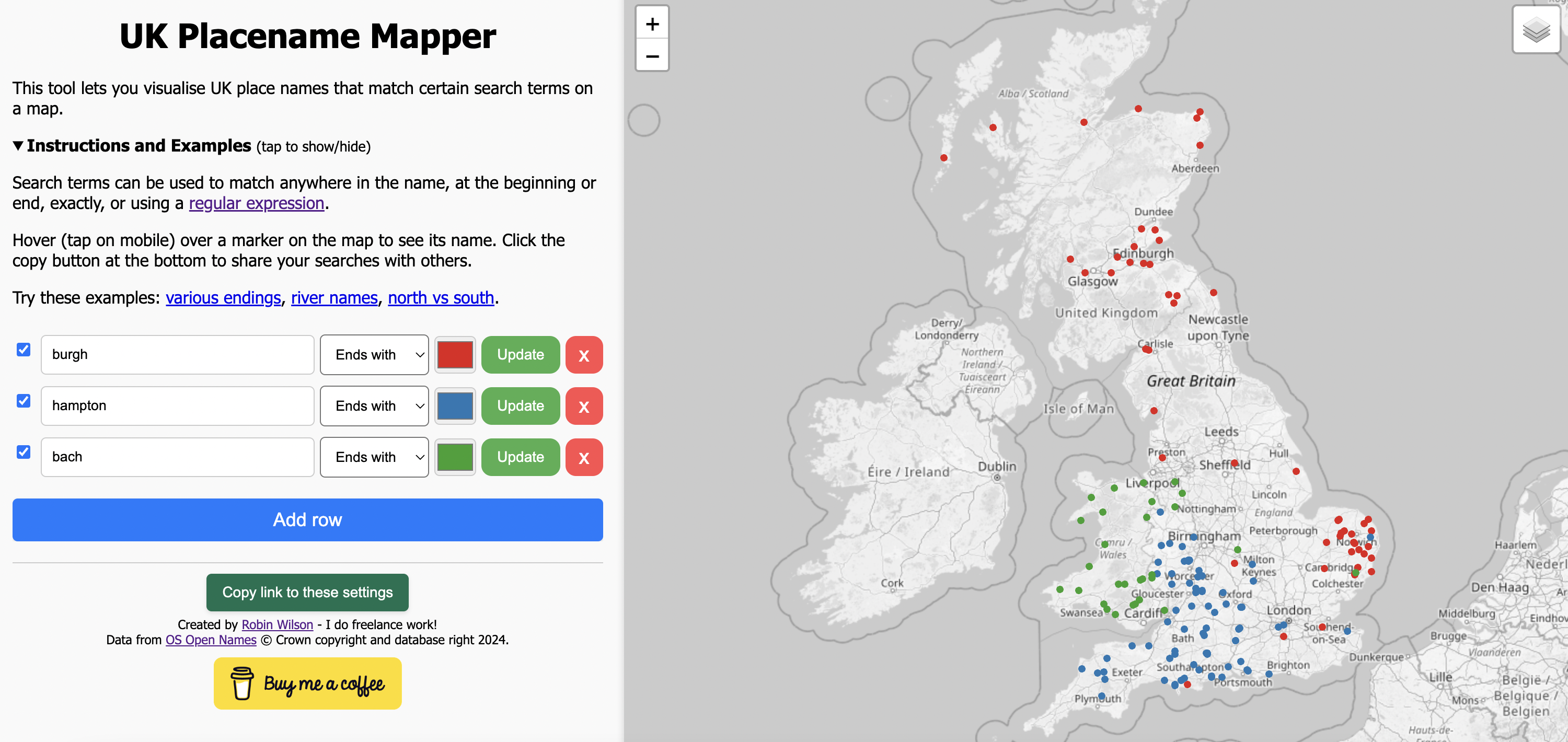
It lets you search for UK place names – things like ‘ends with burgh’ or ‘starts with great’ or ‘contains sea’ – and then plot them on an interactive map. Once you’ve done that, you can even share links to your settings so other people can see your findings.
Have a look at the web app now, and please tweet/toot/email me with any interesting things you find.
A few examples:
- Various different name suffixes
- Names with river names in them
- Names with north in them vs names with south in them
- Names that start and end with the same sequence of letters
The data comes from the Ordnance Survey Open Names dataset, and it was processed on my local machine using Python to create some filtered data that could be used in the webapp, which all runs client-side.
If you found this post useful, please consider buying me a coffee.
This post originally appeared on Robin's Blog.
Categorised as: GIS, My Software, Programming, Python
[…] (which is usually technical content about GIS, remote sensing, Python and data analysis – see a few example posts), and this is part of April Cools – a group of bloggers writing posts that […]