Cloud frequency map for Europe & update to cloud frequency web app
I’ve posted before about the cloud frequency map that I created using Google Earth Engine. This post is just a quick update to mention a couple of changes.
Firstly, I’ve produced some nice pretty maps of the data from 2017 over Europe and the UK respectively. I posted the Europe one to the DataIsBeautiful subreddit and got quite a few upvotes, so people obviously liked the visualisation. The two maps are below – click on the images to get the full resolution copies.

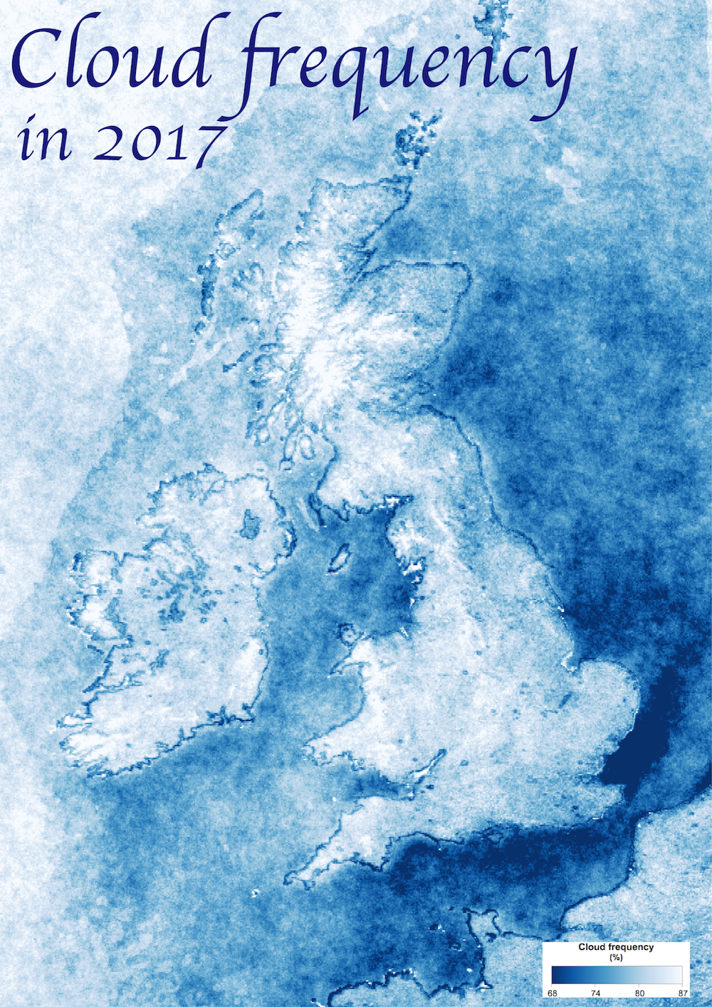
Interestingly, you can see quite a lot of artefacts around the coast – particularly in the UK one. I think this is a problem with the algorithm that occurs around coasts – or at least discontinuities from the different algorithms used over land and water.
I’ve also updated the interactive cloud frequency web app to use data from 2017.
If you found this post useful, please consider buying me a coffee.
This post originally appeared on Robin's Blog.
Categorised as: Academic, GIS, My Software, Remote Sensing
[…] https://blog.rtwilson.com/cloud-frequency-map-for-europe-update-to-cloud-frequency-web-app/ […]