Configuring legends in ArcGIS – a (slightly) less horrible way to do it
I must say that I’m not a huge fan of much of the ArcGIS interface – and I particularly dislike the many levels of nested dialog that you have to use to change various options while creating printed maps. Some of the worst of these are the dialogs for inserting, styling and configuring legends – it nearly always takes me about twenty minutes a nice looking legend – and even then it doesn’t look quite like I want it to.
Anyway, today I’ve found a slightly easier way to do this, which I wanted to share with you.
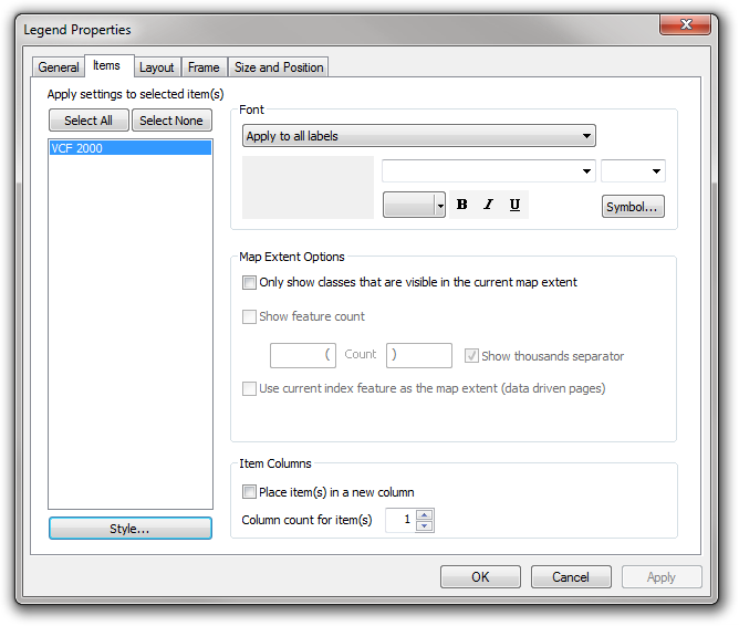
After inserting a legend, if you open the properties dialog you’ll be shown this wonderfully-designed configuration interface, listing all of the layers shown in the legend:
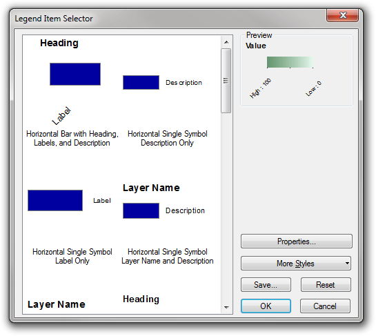
Selecting a layer and clicking the Style button shows you a list of legend styles to choose from:
I assumed that you had to use one of these styles, and if you didn’t like the options then tough! But, I’ve found a way to configure the styles…just click the properties button and you’ll find a dialog with three tabs, with useful options on all of the tabs. One of the things that I often want to do is turn off some of the text that isn’t appropriate for this layer (eg. labels, layer names etc), and this can be done in the first tab by simply ticking or unticking the relevant options:
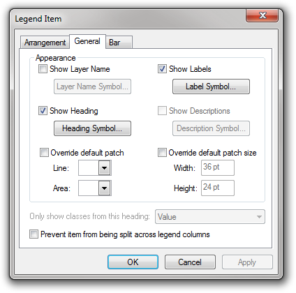
The Bar tab contains a couple of very simple options which allow you to choose the angle of text under raster colour ramp bars – I often find the angled text rather difficult to read, so I tend to set both of these to zero degrees.
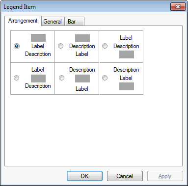
The Arrangement tab provides options to choose how to display the descriptions, labels and headers around the actual symbols and colours themselves:
Unfortunately I can’t seem to get into this Properties dialog box properties when I have more than one layer selected in the first dialog but – and this is something else I didn’t realise – you can save a style that you’ve created so that you can easily use it again: just use the save button in the second dialog box:
I’ve been using ArcGIS for over five years now and had never realised this was possible – so hopefully this will help some other people get slightly less frustrated with ArcGIS! If I helped you then please leave a comment below and let me know.
If you found this post useful, please consider buying me a coffee.
This post originally appeared on Robin's Blog.
Categorised as: Academic, GIS, Remote Sensing
Thank you very much. I also face this problem.
Thanks for sharing